A totally free index of Internet resources for the K-12 Community.
Math and Map Making
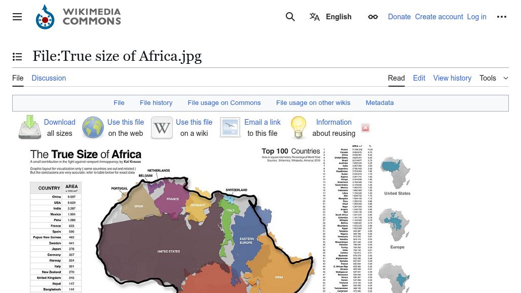
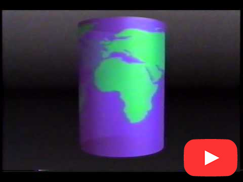
How we view the world depends on what map(s) we use. A map good for navigation might not be good at showing the true size of countries or continents.
You can easily integrate some math concepts, such as scale or navigational geometry, into the study of maps.
These particular sites may or may not be appropriate for the grade level you teach, but they will surely spur your imagination towards getting the most mileage from your study of maps.
If you’re in need of a visual reference guide to the various map projection types… Then, look no further. Because we’ve pumped out a goldmine of the top 50 global map projections used by cartographers. From Aitoff to Winkel, these map projections are your blueprint for designing captivating cartographic masterpieces. Because it’s all about the audience… Let’s… learn more
Africa doesn't look that big on the map. In reality, Africa is bigger than the United States, China, India and a couple of European countries ... combined! learn more
Cartographers face the "orange peel" problem when mapping the surface of Earth onto a flat piece of paper. The mathematician Euler proved that this can not be done without distortion – using an actual orange peal. (clip is from the PBS show "Life by the #s") learn more
A fun on-line game to show how the Mercator projection changes the apparent size of a country depending on its latitude. The goal of the game is to drag the countries into their correct location on the map. Not as easy as you might think, especially with the smaller countries. Drag the country outline over… learn more
Good for older students, this paper looks at the problem of map making and navigation – coming up with a way so that a ship's course could be plotted using a ruler. Today we know it as the Mercator projection. learn more
In 1492 when Columbus crossed the Atlantic, although latitude could be measured (typically from observations of the Pole Star), there was no reliable way of measuring a ship's longitude once out of sight of land. Charts were inaccurate and incomplete and much of the World remained unexplored. This article explores the various ideas for measuring… learn more
From the people who brought you 50 Map Projections, this post looks at how map projections are made and why different map projections have different strengths and weaknesses. They are preserving different attributes. learn more
Michael Stevens has an interesting look at perception and how our maps have shaped the perception of the Earth. Use the YouTube link to access all the resources he mentions in the video. learn more