
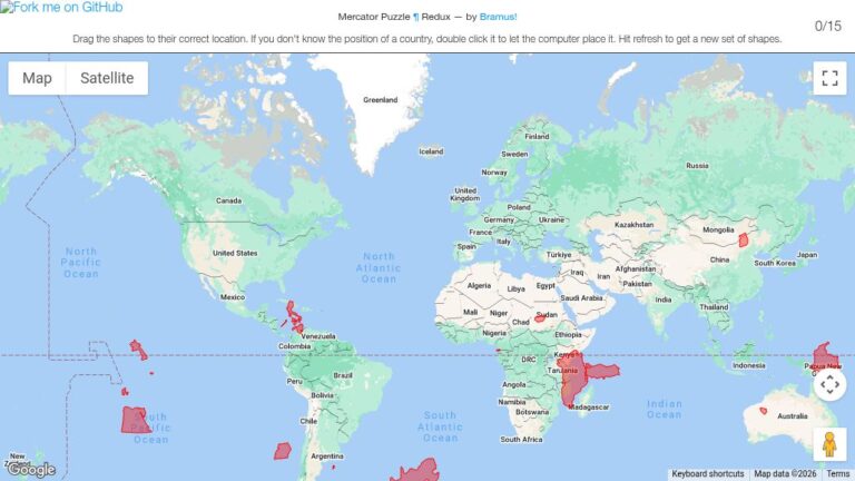
A fun on-line game to show how the Mercator projection changes the apparent size of a country depending on its latitude. The goal of the game is to drag the countries into their correct location on the map. Not as easy as you might think, especially with the smaller countries.
Drag the country outline over your location to compare how large that country is compared to your state or region.
If you don’t know the position of a country, double click it to let the computer place it. This version of the puzzle displays different countries with each refresh.