Remote Sensing Technology

Science in the making can be a very powerful motivator. Even if you are unable to participate in these particular projects, it may be worthwhile to contact them for future involvement and for understanding how your school could replicate this model of remote sensing technology, synthesized with historical data.

Filters:
resource URL thumbnail

Data Science Games

The good news is your project works. The bad news is that you now have LOTS of data that needs to be analyzed. What do you do with big data sets? This Concord Consortium decided what better way to learn the basics of this new, essential field than through games? A data science game generates…  learn more

resource URL thumbnail

Drones in remote sensing

Dr. Anita Simic, a geology faculty member at Bowling Green State University, is a firm believer in engaging her students in scientific exploration. And for her there is no better way to demonstrate the power of science than to explore the concept of remote sensing using a drone. This article explores how she got started…  learn more

resource URL thumbnail

Earthshots

EarthShots, from the USGS, introduces remote sensing by showing how satellite imagery is used to track change over time. The site provides outstanding images of sites around the world which have undergone significant environmental changes due to natural and human causes. A good site for students to illustrate contrasts in a research report. Sometimes a…  learn more

resource URL thumbnail

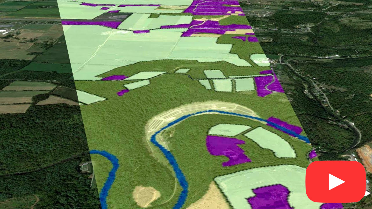
Mapping the Invisible

This video explores the basic principles used by optical sensors like Landsat, AVIRIS, and other remote sensing sensors to record the things that we can't see with our eyes - like the health of plants on the ground. It explains the basic principles of the electromagnetic spectrum, bands and spectral resolution in data and the…  learn more

resource URL thumbnail

NASA Ozone & Air Quality

The Ozone and Air Quality NASA site illustrates the mapping of the ozone layer using spectrometers. It provides tools and data sets for student use.  learn more

resource URL thumbnail

Sally Ride EarthKAM

Middle school students around the world can request images of specific locations on Earth during Sally Ride EarthKAM missions – periods when the Sally Ride EarthKAM camera in the International Space Station is operational. Sign your class up for a space mission. Really!  learn more

resource URL thumbnail

Space Weather

At Space Weather, updated daily by Dr. Tony Phillips, students can learn about meteor showers, solar flares, auroras, and near-Earth asteroids.  learn more

resource URL thumbnail

What is Remote Sensing?

Remote sensing is the science of obtaining information about objects or areas from a distance, typically from aircraft or satellites. Here's a quick overview from NOAA.  learn more