
The United States is a big place and it’s hard to have a feeling for where all of the people live. There are hundreds of millions of people after all. So many Americans.
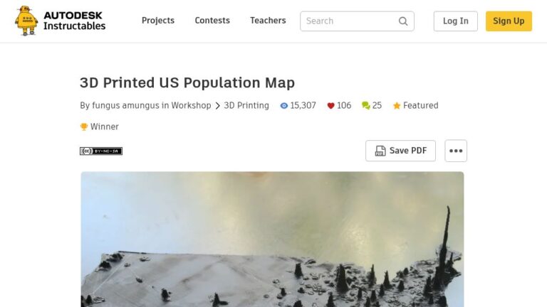
To get a better grasp of this, the post’s author made a 3D map of the US based on the population density of each county. The more people per square mile, the taller it gets. Then, to actually feel it, they printed the whole thing up on their 3D printer. Here’s how that came to be.